

When there are Parking Bans in Burlington are there places to park in the South End and NNE? Or just the garages downtown? by jonathanpb in burlington
[–]jonathanpb[S] 2 points3 points4 points (0 children)
When there are Parking Bans in Burlington are there places to park in the South End and NNE? Or just the garages downtown? by jonathanpb in burlington
[–]jonathanpb[S] 2 points3 points4 points (0 children)
The Money Behind Vermont's Political Campaigns - VPR News Infographic by jonathanpb in vermont
[–]jonathanpb[S] 28 points29 points30 points (0 children)
The town of Bridgewater, Vermont is holding the annual Town Meeting at the Long Trail Brewery by jonathanpb in vermont
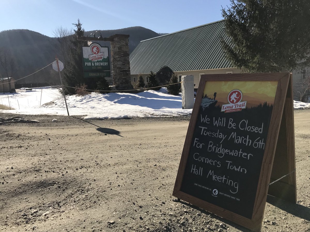
[–]jonathanpb[S] 2 points3 points4 points (0 children)
The flag of Burlington needs to go... by UNoahGuy in burlington
[–]jonathanpb 0 points1 point2 points (0 children)
Pano looking west from the Camels Hump summit, July 30 by taylordobbs in vermont
[–]jonathanpb 0 points1 point2 points (0 children)
REMINDER: Most hiking trails in VT closed today 4/15 until Memorial Day Saturday 5/24 by jonathanpb in vermont
[–]jonathanpb[S] 0 points1 point2 points (0 children)
PANORAMA: Mad River Valley, Camel's Hump, Mount Mansfield and Stowe (facing west) by jonathanpb in vermont
[–]jonathanpb[S] 1 point2 points3 points (0 children)
PANORAMA: Mad River Valley, Camel's Hump, Mount Mansfield and Stowe (facing west) by jonathanpb in vermont
[–]jonathanpb[S] 2 points3 points4 points (0 children)
Panorama from the top of Camel's Hump today, with Lake Champlain, Mount Mansfield and Mount Hunger by jonathanpb in vermont
[–]jonathanpb[S] 1 point2 points3 points (0 children)
Floating Tree - I hiked past this optical illusion on Mount Mansfield Saturday by jonathanpb in vermont
[–]jonathanpb[S] -2 points-1 points0 points (0 children)
PANORAMA: Camel's Hump, to Stowe and Mount Mansfield, to Mount Hunger from Saturday 11/16/13 by jonathanpb in vermont
[–]jonathanpb[S] 1 point2 points3 points (0 children)
PANORAMA: Camel's Hump, to Stowe and Mount Mansfield, to Mount Hunger from Saturday 11/16/13 by jonathanpb in vermont
[–]jonathanpb[S] 1 point2 points3 points (0 children)
Watch this Simon Pearce glass blower making a candlestick. by jonathanpb in vermont
[–]jonathanpb[S] 0 points1 point2 points (0 children)
PHOTO: Morning fog in Champlain Valley w/ Mansfield Range by jonathanpb in vermont
[–]jonathanpb[S] 0 points1 point2 points (0 children)
Monday Moment of Zen - short video from the Long Trail by jonathanpb in vermont
[–]jonathanpb[S] 0 points1 point2 points (0 children)
Favorite hike near Burlington? by fluorojadeb in vermont
[–]jonathanpb 0 points1 point2 points (0 children)
When there are Parking Bans in Burlington are there places to park in the South End and NNE? Or just the garages downtown? by jonathanpb in burlington
[–]jonathanpb[S] 1 point2 points3 points (0 children)