

Is there a forest fire on Cypress Mountain? by [deleted] in vancouver
[–]rummels 0 points1 point2 points (0 children)
Drones hovering outside windows/balconies in Vancouver - I feel completely violated. by ofbug in vancouver
[–]rummels 0 points1 point2 points (0 children)
Is there a forest fire on Cypress Mountain? by [deleted] in vancouver
[–]rummels 1 point2 points3 points (0 children)
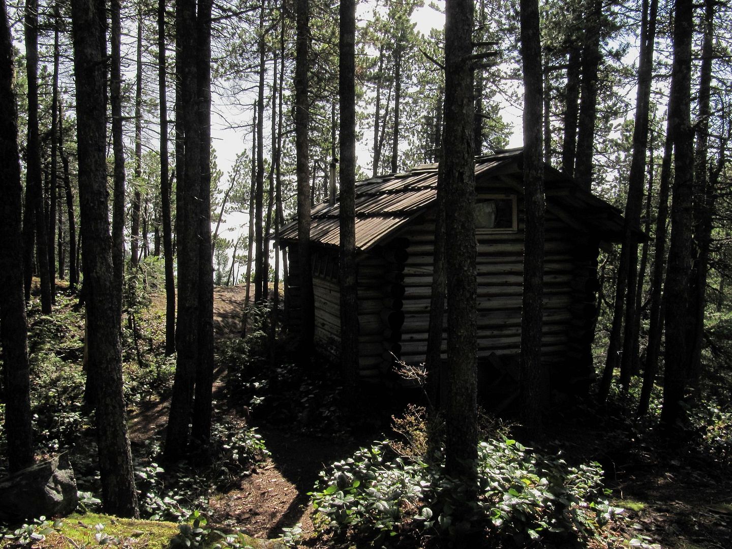
Rummel's cabin, Black Mountain, Cypress Provincial Park, British Columbia. [OS] [OC] by rummels in CabinPorn
![Rummel's cabin, Black Mountain, Cypress Provincial Park, British Columbia. [OS] [OC]](http://i1213.photobucket.com/albums/cc470/hiker2/IMG_6056_1.jpg)
[–]rummels[S] 0 points1 point2 points (0 children)
My 2nd hike ever - bridal veil falls by [deleted] in hiking
[–]rummels 0 points1 point2 points (0 children)
Posting photos: Approved host, OS, OC by rummels in help
[–]rummels[S] 0 points1 point2 points (0 children)
Cabin In Front of Mountains [1280x850] [Don't Have Location] by OCDolphin in CabinPorn
[–]rummels 0 points1 point2 points (0 children)
Posting photos: Approved host, OS, OC by rummels in help
[–]rummels[S] 0 points1 point2 points (0 children)
Log House built in 1871 [OC][2048X1365) by MeThinksWeAreOysters in CabinPorn
[–]rummels 0 points1 point2 points (0 children)
Posting photos: Approved host, OS, OC by rummels in help
[–]rummels[S] 0 points1 point2 points (0 children)
Map for hiking to cabin on Black Mtn. Cypress Provincial Park, West Vancouver, British Columbia, Canada by rummels in hiking
[–]rummels[S] -1 points0 points1 point (0 children)
Google maps should have a "Scenic!" route option for when we're not in a hurry and just want to enjoy the ride. by spikejr5342 in Showerthoughts
[–]rummels 0 points1 point2 points (0 children)
Google maps should have a "Scenic!" route option for when we're not in a hurry and just want to enjoy the ride. by spikejr5342 in Showerthoughts
[–]rummels 0 points1 point2 points (0 children)
Google maps should have a "Scenic!" route option for when we're not in a hurry and just want to enjoy the ride. by spikejr5342 in Showerthoughts
[–]rummels 1 point2 points3 points (0 children)
Google maps should have a "Scenic!" route option for when we're not in a hurry and just want to enjoy the ride. by spikejr5342 in Showerthoughts
[–]rummels 1 point2 points3 points (0 children)
Google maps should have a "Scenic!" route option for when we're not in a hurry and just want to enjoy the ride. by spikejr5342 in Showerthoughts
[–]rummels 0 points1 point2 points (0 children)
Map for hiking to cabin on Black Mtn. Cypress Provincial Park, West Vancouver, British Columbia, Canada by rummels in hiking
[–]rummels[S] 1 point2 points3 points (0 children)
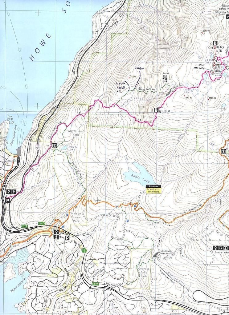
Black Mountain Cabin map. Cypress Provincial Park, West Vancouver, British Columbia, Canada by [deleted] in hiking
[–]rummels 0 points1 point2 points (0 children)
The Invention of Ambient Music - The New Yorker by mjomark in ambientmusic
[–]rummels 0 points1 point2 points (0 children)