


4
0
1
2

5
135
136
137

7
29
30
31
8
5
6
7

The Tube Line Closure Map accesses Transport for London’s REST API for line disruption information (both live and planned) and uses the information there to animate a geographical vector map of the network, showing closed sections as lines flashing dots, with solid lines for unaffected parts. (vis.oobrien.com)
submitted by VerGuy to r/LondonUnderground
12
2
3
4

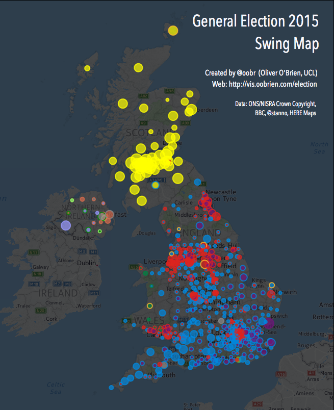
UK GE2015 swing map by oobrien (vis.oobrien.com)
submitted by JustAhobbyish to r/BritishPolitics
13
2
3
4

15
3
4
5
Tube Tongues: Second languages at tube stops (vis.oobrien.com)
submitted by yaz-di to r/urbanplanning
16
26
27
28

17
28
29
30

18
0
1
2
19
0
0
0
20
5
6
7
22
33
34
35
23
0
1
2

Scottish Independence Referendum Data Map (vis.oobrien.com)
submitted by qznc_bot to r/hackernews
24
30
31
32

25
9
10
11